Miya-juku 宮宿
| Tōkaidō (東海道) | Station 41 of 53 · Nihonbashi (Edo) → Kyoto |
|---|---|
| Present-day location | Atsuta-ku, Aichi, Japan |
| Prefecture | Aichi (Chubu region) |
| Distance from Nihonbashi | About 349 km (by the historical station tables) |
| Next station | Kuwana-juku — about 27.5 km on |
| Coordinates | 35.1289° N, 136.9143° E |
Miya-juku (宮宿, Miya-juku) was the forty-first of the fifty-three stations of the Tōkaidō. It is located in former Owari Province in what is now part of the Atsuta-ku section of the city of Nagoya, in Aichi Prefecture, Japan. It was six km from Narumi-juku, the preceding post station.
History
In addition to being a post station on the Tōkaidō, Miya-juku was also part of the Minoji (a minor route which runs to Tarui-juku on the Nakasendō) and the Saya Kaidō. As a result, it had the most hatago of any post station along the Tōkaidō, with two honjin, one wakihonjin and 248 lesser inns.
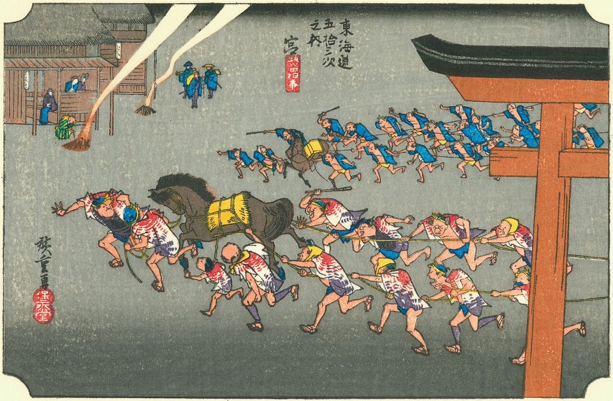
The classic ukiyo-e print by Andō Hiroshige (Hōeidō edition) from 1831 to 1834 depicts two gangs of men dragging a portable shrine cart (not shown) past a huge torii gate. The torii gate is the symbol of a Shinto shrine, and the name of "Miya" also means a "Shinto shrine". The shrine in question is the famous Atsuta Shrine, one of the most famous in Japan and a popular pilgrimage destination in the Edo period. The area is now part of downtown Nagoya metropolis.
Neighboring post towns
- Tōkaidō
- Narumi-juku - Miya-juku - Kuwana-juku
- Saya Kaidō
- Miya-juku (starting location) - Iwazuka-juku
- Minoji
- Miya-juku (starting location) - Nagoya-juku
Text adapted from the English Wikipedia article Miya-juku by its contributors, licensed CC BY-SA 4.0. Station facts cross-checked with the road station lists (Japanese Wikipedia, CC BY-SA 4.0) and Wikidata (CC0).