Kanaya-juku 金谷宿
| Tōkaidō (東海道) | Station 24 of 53 · Nihonbashi (Edo) → Kyoto |
|---|---|
| Present-day location | Shimada, Shizuoka, Japan |
| Prefecture | Shizuoka (Chubu region) |
| Distance from Nihonbashi | About 208 km (by the historical station tables) |
| Next station | Nissaka-shuku — about 6.5 km on |
| Coordinates | 34.8227° N, 138.12874° E |
34°49′N 138°08′E / 34.82°N 138.13°E / 34.82; 138.13Kanaya-juku (金谷宿, Kanaya-juku) was the twenty-fourth of the fifty-three stations of the Tōkaidō. It is located in what is now part of Shimada, Shizuoka Prefecture, Japan. During the Edo period, it was the easternmost post station of Tōtōmi Province.
History
Kanaya-juku was built up on the right bank of the Ōi River across from Shimada-juku. There were over 1,000 buildings in the post town, including three honjin, one sub-honjin and 51 hatago. Travelers had an easy travel to Nissaka-shuku, which was about 6.5 km (4.0 mi) away. However, whenever the river's banks overflowed, travelers were not able to pass through Kanaya and on to Shimada-juku, as the Tokugawa shogunate had expressly forbidden the construction of any bridge on the Ōi River.
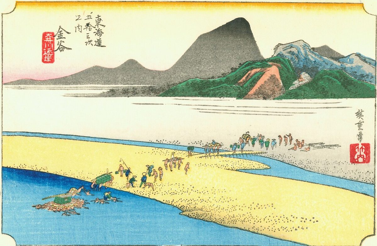
The classic ukiyo-e print by Andō Hiroshige (Hōeido edition) from 1831–1834 depicts a daimyō procession on sankin-kōtai crossing the river. The daimyō is riding in a kago, held above the water by a makeshift platform carried by numerous porters. His retainers are attempting to wade across the river. In the background, a small village is shown in the foothills.
Neighboring post towns
- Tōkaidō
- Shimada-juku - Kanaya-juku - Nissaka-shuku
Text adapted from the English Wikipedia article Kanaya-juku by its contributors, licensed CC BY-SA 4.0. Station facts cross-checked with the road station lists (Japanese Wikipedia, CC BY-SA 4.0) and Wikidata (CC0).