Home / Tōkaidō / Kanagawa-juku
Kanagawa-juku 神奈川宿
| Tōkaidō (東海道) | Station 3 of 53 · Nihonbashi (Edo) → Kyoto |
|---|---|
| Present-day location | Yokohama, Kanagawa, Japan |
| Prefecture | Kanagawa (Kanto region) |
| Distance from Nihonbashi | About 27.5 km (by the historical station tables) |
| Next station | Hodogaya-juku — about 4.9 km on |
| Coordinates | 35.47278° N, 139.63228° E |
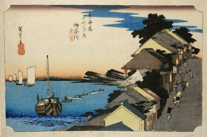
35°28′30″N 139°37′59″E / 35.474995°N 139.632958°E / 35.474995; 139.632958Kanagawa-juku (神奈川宿, Kanagawa-juku) was the third of the fifty-three stations of the Tōkaidō. It was located in Kanagawa-ku in the present-day city of Yokohama, Kanagawa Prefecture, Japan. It was close to Kanagawa Port. Many of its historical artifacts were destroyed by the Great Kantō earthquake and bombings during World War II.
History
Kanagawa-juku was established parallel to Kanagawa Port and it flourished as part of the route that goods traveled on the way to Sagami Province. Though the area had officially been designated as the place for the port to be opened, it was actually opened on the opposite shore in what is now Naka-ku, Yokohama.
After the country was opened to international trade, the center of commerce was moved to the opposite shore as well. In 1889, the town of Kanagawa was established, and it eventually merged into Yokohama in 1901.
Neighboring post towns
- Tōkaidō
- Kawasaki-juku - Kanagawa-juku - Hodogaya-juku
Text adapted from the English Wikipedia article Kanagawa-juku by its contributors, licensed CC BY-SA 4.0. Station facts cross-checked with the road station lists (Japanese Wikipedia, CC BY-SA 4.0) and Wikidata (CC0).